![Grief Gives Way to Vengeance in ‘The Last of Us’ Season 2, Episode 3 [Spoiler Recap]](https://bloody-disgusting.com/wp-content/uploads/2025/04/bella-ramsey_5.jpg)
![Defending the Maligned ‘Alien Resurrection’ [Horror Queers Podcast]](https://bloody-disgusting.com/wp-content/uploads/2025/04/Alien-Resurrection.png)
![‘The Other’ Poster Reveal – ‘Final Destination’ Creator and ‘Hellbent’ Director Join Forces [Exclusive]](https://i0.wp.com/bloody-disgusting.com/wp-content/uploads/2025/04/Screenshot-2025-04-28-130028.png?fit=1096%2C727&ssl=1)
![‘Sweetest Day’ Poster – Slash Into Your New Favorite Holiday [Exclusive]](https://bloody-disgusting.com/wp-content/uploads/2025/04/sweetestday-header.jpg)


![Marriott Is Now Advertising Hotels In North Korea [Roundup]](https://viewfromthewing.com/wp-content/uploads/2025/04/ChatGPT-Image-Apr-27-2025-04_25_59-AM.jpg?#)


Satellite Photos Show How Deadly Myanmar Earthquake Transformed the Earth’s Surface
One month ago, a powerful and deadly magnitude 7.7 earthquake hit central Myanmar, devastating the southeast Asian country and killing at least 5,400 people. Scientists are investigating the geological impacts of the tragedy using satellites, discovering that the earthquake transformed the Earth itself in Myanmar. [Read More]
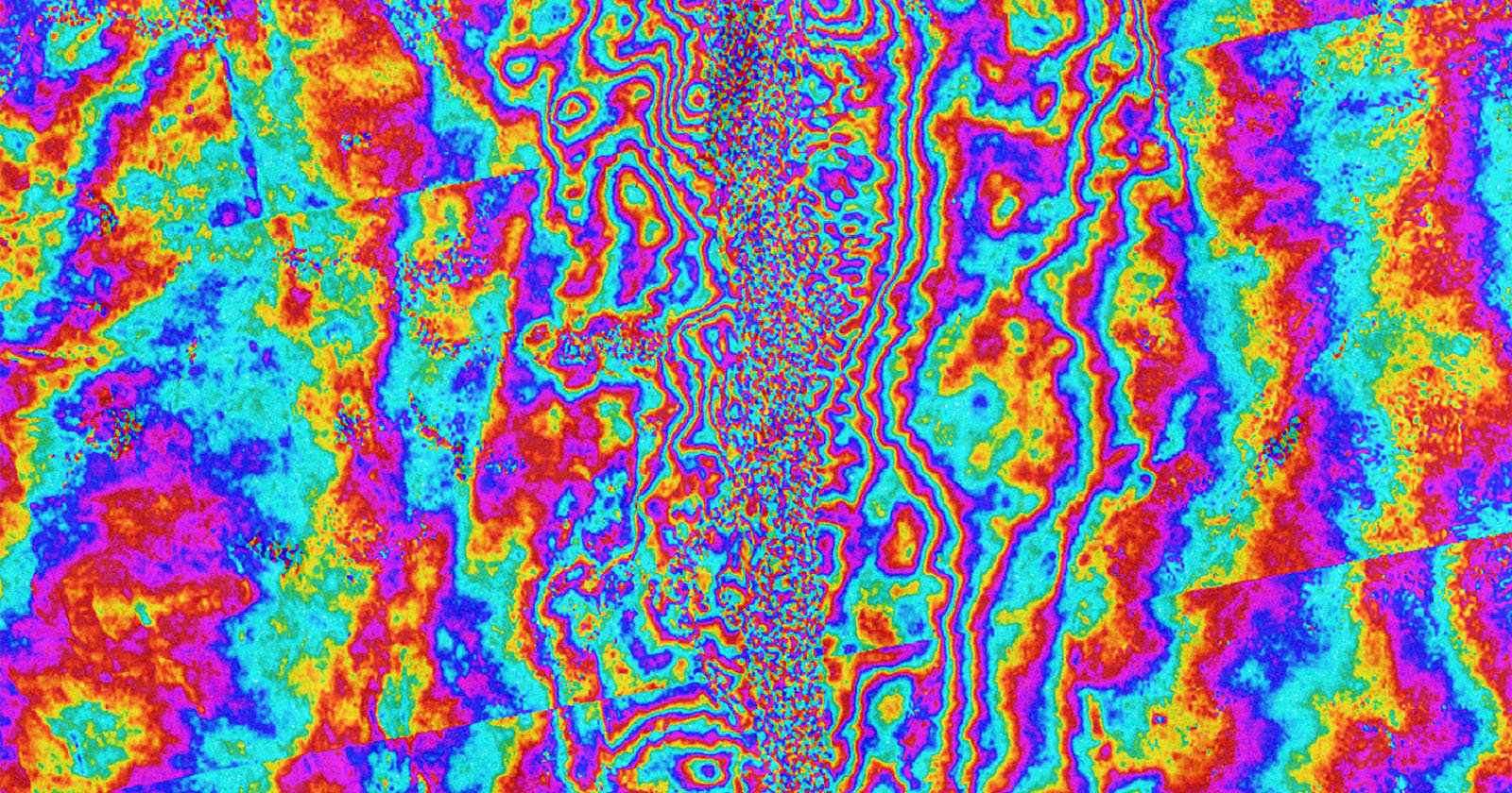
One month ago, a powerful and deadly magnitude 7.7 earthquake hit central Myanmar, devastating the southeast Asian country and killing at least 5,400 people. Scientists are investigating the geological impacts of the tragedy using satellites, discovering that the earthquake transformed the Earth itself in Myanmar.